
Allmaps Viewer
Allmaps Viewer lets you compare historical maps with a modern basemap and inspect their original IIIF images. It fetches IIIF image tiles directly from the institutions that host them and uses WebGL to warp and display them in your browser.
Try it with the Atlas of the city of Lynn, Massachusetts from the Leventhal Map & Education Center.
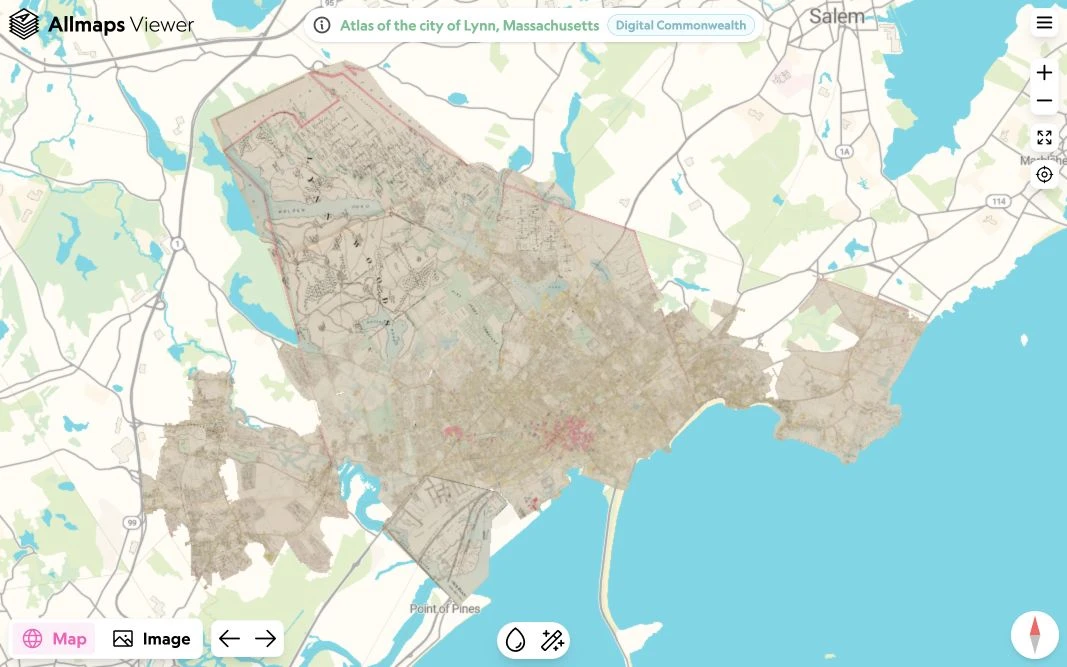
Open a map
- Open Allmaps Viewer.
- Paste the URL of a Georeference Annotation, Annotation Page, or IIIF Manifest into the input field and press Enter.
- Allmaps Viewer loads the georeferenced maps and zooms to their location.
When you open a IIIF Manifest, Allmaps Viewer loads its embedded Georeference Annotations and looks for associated maps in the Allmaps database.
You can also paste the complete JSON contents of an annotation or Manifest, or drag and drop a JSON file onto the input field.
If a map has not been georeferenced yet, follow the georeferencing guide to get started in Allmaps Editor.
Compare the map and original image
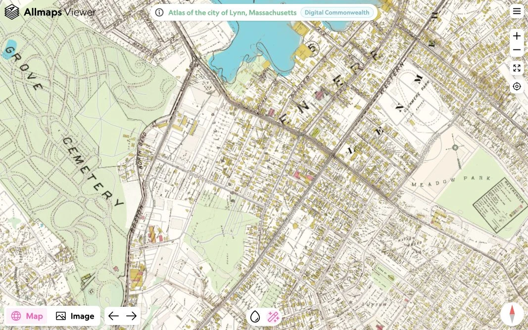
Use Map to see the historical map warped into its geographic position over a modern basemap. Zoom and pan to explore how streets, buildings, and other features have changed.
Adjust the opacity to make the historical map more transparent and compare it with the basemap underneath.
To see the basemap through the paper, select the magic wand button. Viewer estimates the background color from the most common color inside the map mask and makes pixels close to that color transparent. This leaves streets and labels visible while revealing more of the basemap. Map details close to the background color can fade too. Select the button again to restore the original colors.
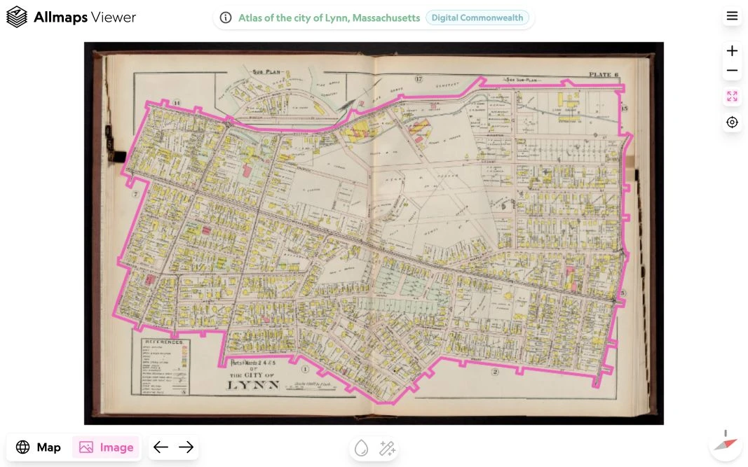
Use Image to inspect the original IIIF image without warping, including margins, legends, and other details outside the map mask. The pink line marks the mask. Switch back to Map to see the map in its geographic context.
View multiple maps
An Annotation Page or IIIF Manifest can contain georeferencing data for several maps. Allmaps Viewer displays them together in Map view, so you can explore maps made up of multiple sheets or compare maps covering the same area.
Use the previous and next map buttons to select a map. Switch to Image to inspect the original IIIF image of the selected map.
You can also use [ and ] to select the previous or next map.
Share a map
Copy the Allmaps Viewer URL from your browser’s address bar to share the maps you have opened.
When sharing from Allmaps Editor, open Export, choose which maps to share, and copy the View in Allmaps Viewer link.
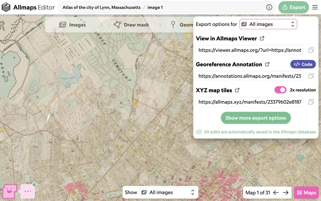
When the Export panel offers a version choice, choose how the link should handle future edits:
- Latest version uses the latest georeferencing data. Anyone opening or reloading the link sees changes made in Allmaps Editor.
- Current version links to the georeferencing data as it is when you share it. This option applies to a single map or the maps on one image.
Links for all images in a Manifest or Collection use the latest version.
Versioned links preserve the georeferencing data, including ground control points and masks. The original IIIF images are still loaded from the institution that hosts them. See Versions and shared edits for an example of a versioned annotation URL.
To add a georeferenced map to your own website, see Allmaps plugins.