
GeoJSON footprints
Use GeoJSON to display map footprints in GIS software or on a web map. Each footprint represents a map’s mask transformed into geographic coordinates. This is useful for showing which areas your maps cover and making maps searchable by location, for example by storing the footprints in PostGIS with a spatial index. The GeoJSON contains the footprints and map metadata, but not the map images.
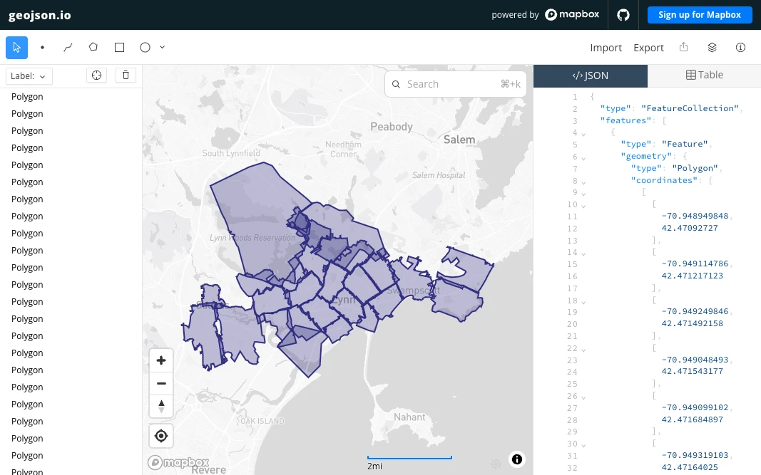
Map footprints from the Atlas of the city of Lynn, Massachusetts.
How it works
Allmaps uses the ground control points in a Georeference Annotation to calculate a transformation from image coordinates to geographic coordinates. It applies this transformation to the map’s mask, which defines the part of the image that contains the map. The resulting polygon is the map’s geographic footprint.
The Allmaps Annotations API returns this footprint as the geometry of a GeoJSON Feature, with map metadata in its properties. You can use these polygons to find maps that cover a location or overlap an area.
Get GeoJSON footprints
The Allmaps APIs can return GeoJSON for a single map, all georeferenced maps on an image or in a IIIF Manifest, or a search result:
| Maps | GeoJSON | Preview |
|---|---|---|
| A single map | /maps/ |
View in geojson.io |
| Maps on an image | /images/ |
View in geojson.io |
| Lynn atlas (IIIF Manifest) | api.allmaps.org/ |
View in geojson.io |
| Maps covering a location | /maps.geojson |
View in geojson.io |
A single map returns a GeoJSON Feature; multiple maps return a FeatureCollection. Download the GeoJSON or load its URL directly into a tool that supports it. Select View in geojson.io to explore the footprints on an interactive map.
See the Annotations API documentation for available filters and query parameters.
To turn traced features or OCR results into GeoJSON, see Transforming OCR and other annotations, including the Annotorious example.